


NRW021 Voting District, St. Louis County, Missouri
About
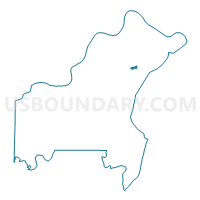
Outline

Summary
| Unique Area Identifier | 610000 |
| Name | NRW021 Voting District |
| County | St. Louis County |
| State | Missouri |
| Area (square miles) | 0.34 |
| Land Area (square miles) | 0.34 |
| Water Area (square miles) | 0.00 |
| % of Land Area | 100.00 |
| % of Water Area | 0.00 |
| Latitude of the Internal Point | 38.73210740 |
| Longtitude of the Internal Point | -90.30655670 |
Maps


Graphs
Select a template below for downloading or customizing gragh for NRW021 Voting District, St. Louis County, Missouri


Neighbors
Neighoring Voting District (by Name) Neighboring Voting District on the Map
- AP038 Voting District, St. Louis County, MO
- NOR004 Voting District, St. Louis County, MO
- NOR010 Voting District, St. Louis County, MO
- NOR012 Voting District, St. Louis County, MO
- NRW024 Voting District, St. Louis County, MO
- NRW025 Voting District, St. Louis County, MO
Top 10 Neighboring County Subdivision (by Population) Neighboring County Subdivision on the Map
- Airport township, St. Louis County, MO (35,821)
- Norwood township, St. Louis County, MO (33,914)
- Normandy township, St. Louis County, MO (32,516)
Top 10 Neighboring Place (by Population) Neighboring Place on the Map
- Ferguson city, MO (21,203)
- Berkeley city, MO (8,978)
- Normandy city, MO (5,008)
- Cool Valley city, MO (1,196)